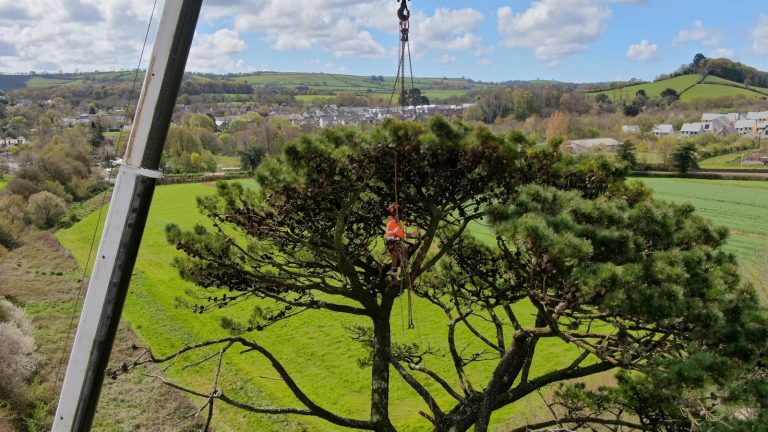
Drone tree surveys offer a highly efficient and minimally disruptive way to assess large sites, inaccessible trees or canopy structures that are otherwise difficult to inspect. Using high-resolution aerial imaging, we capture detailed visuals from multiple angles, enabling clear identification of deadwood, dieback, storm damage, canopy asymmetry, sparse foliage or other defects that may not be visible from the ground.
This technology is ideal for inspecting trees in sensitive or restricted areas—such as riversides, steep banks, wildlife habitats or private estates—where climbing or machinery access is limited. Drone imagery can also be integrated into mapping systems, providing accurate condition data and supporting baseline monitoring over time.
For long-term management, drones offer a repeatable monitoring tool that helps track changes in canopy density, disease progression or storm-related impacts. The resulting visual records are highly valuable for management plans, development proposals and planning submissions.
Drone surveys improve safety, reduce site disturbance and provide a comprehensive understanding of canopy condition with exceptional clarity. Contact our consultants today!